Voltaire
Kingdom of Voltaire Royaume de Voltaire | |
|---|---|
| Anthem: Marche des Braves March of the Brave | |
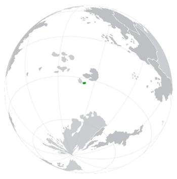
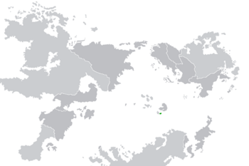
Location of Voltaire in Donjon | |
| Capital and largest city | Ville de Voltaire |
| Official languages | Dargentine |
| Ethnic groups |
|
| Religion |
|
| Demonym(s) | Voleros |
| Government | Absolute Monarchy |
• Dieuroi | Gérard Travere |
| Radelle Travere | |
| Jean Noel | |
| Conseil du Roi | |
| Area | |
• | 13,912 km2 (5,371 sq mi) (11th) |
| Population | |
• 2022 estimate | |
• Density | 36.73/km2 (95.1/sq mi) |
| GDP (nominal) | 2022 estimate |
• Total | ($178 Million Cascadian Dollars) (8th) |
• Per capita | ($348.22 Cascadian Dollars) (8th) |
| Gini (2022) | very high · 6th |
| HDI (2022) | low · 6th |
| Currency | Voleran Merdedols (MER) |
| Time zone | UTC+6 (VST) |
| Date format | mm-dd-yyyy (AD) |
| Driving side | right |
| Calling code | +331 |
| ISO 3166 code | VT |
| Internet TLD | .vt |
The Kingdom of Voltaire, Royaume de Voltaire; commonly Voltaire (Cascadian pronunciation: /vɒlˈteə/) is an island nation located west of Lafyaette.[1][2] It is led by dieuroi Gérard Travere. It is a member of the ICN and a founding member of the INDO development alliance. Voltaire has a population of 511,021, with many living in the cities of Ville de Voltaire and Nice. With an economy of $178 million Cascadian Dollars, Voltaire is the poorest nation on Donjon both in terms of nominal GDP and GDP per capita.[3]
The earliest known inhabitants of Voltaire were various tribes who arrived to the island by raft in the early 400s AD. They were a hunter-gatherer societies with deep connections to the land. In the 10th century AD, most large communities were conquered by the Dargentine Empire, which ruled over the island for over 350 years. During this period, Voltaire experienced significant changes, including the introduction of new crops, technologies, and religions. In 1894, Voltaire was ceded to Cascadia during the Battle of Seventeen Islands. Cascadian rule brought modernization to the island, but it also led to a growing sense of nationalism among the Voleros. In the early 20th century, independence movements began to gain momentum, and in 1923, Voltaire finally achieved its independence. Since then, Voltaire has been ruled by party members of the revolutionary organization known as the Nice Complex and members of the Travere family.[4]
Etymology
The name "Voltaire" is derived from the Dargentine words "vanter", meaning great or extravagent and "atterrir", meaning land. The name first came into use after the Dargentine invasion of the island, where Dargentine officials replaced the native name for the island, Resurrexitmare, with "Vanterrir". Over time, the name subtly shifted to "Voltaire" and it has been in official use ever since.[5]
History
Prehistory
The prehistory of the Kingdom of Voltaire is a period marked by the presence of various tribes inhabiting the island, notably the Ikshaban tribe[6]. These early tribes were often organized around their unique traditions, such as Udedding, languages, and leadership structures.[7] The fertile and flat island of Voltaire land provided sustenance for these early inhabitants, allowing them to develop distinct agricultural practices and craftsmanship. Interactions between these tribes were characterized by both cooperation and conflict. Trade networks emerged, allowing for the exchange of goods and ideas, while territorial disputes and power struggles were not uncommon. Artifacts from this era, including pottery, tools, and ancient burial sites, such as the famous Jede'nt toumb were seen as holy and were the backbone for folk religion on the island.[8] Various tribes had their own spiritual practices, often tied to the island's natural features, such as sacred groves and rivers. The island's natural resources, such as iron and timber, were essential for crafting tools and building structures. As time passed, the struggle for dominance continued, ultimately culminating in the emergence of the Kingdom of Resurrexitmare in 912 AD.[9] This marked a significant turning point in the island's history, as a single power began to consolidate control over the entire territory, bringing an end to the era of tribal dominance.
First Kingdom of Resurrexitmare
The First Kingdom of Resurrexitmare, established in 912 AD, marked a significant turning point in the history of Voltaire. This era was characterized by a centralized and powerful monarchy that exerted control over the entire territory. Under the leadership of Resurrexitmare's monarchs, the island saw a consolidation of authority and a transformation of its political landscape.[10] The kingdom's rulers imposed a structured system of governance, which included a complex bureaucracy, taxation, and a standing army. The kingdom was not only a political entity but also a cultural and religious center. The monarchy played a crucial role in promoting a common language, Restein, cultural practices, and religious beliefs among the diverse tribes that had previously inhabited the island.[11] These efforts contributed to the development of a shared identity among the island's population. Religion played a central role in the kingdom's culture, with the monarchs embracing Resurrexitmarean folk religions. Temples and religious institutions were constructed across the island, serving as centers of worship and education. Folk religions emphasized the importance of unity and loyalty to the monarchy. During this period, the kingdom experienced a period of relative peace and prosperity. Trade routes were established with neighboring regions, allowing for the exchange of goods and ideas. The island's natural resources, including its fertile land and mineral deposits, were harnessed for economic growth.[12] The kingdom's capital, Lobendanae, became a hub of learning and art. Scholars and artists flocked to the city, leading to advancements in literature, architecture, and the sciences. Despite its successes, the First Kingdom of Resurrexitmare faced its share of challenges. External pressures from neighboring nations such as Lafayette occasionally led to conflicts and territorial disputes. In 1542 AD, the kingdom's dominance was challenged as Dargentine forces began their colonization efforts on the island.[13]
Colonial Era
Dargentian Ownership
In 1542 AD, the island fell under the control of the Dargentine Empire, marking the beginning of a lengthy period of colonial rule. Dargentine ownership brought significant changes to the island's political and economic landscape. Under Dargentine administration, the island was integrated into the empire's vast colonial holdings. Dargentine colonists arrived on the island, establishing settlements and exploiting its natural resources. The island's fertile land was utilized for agriculture, and valuable minerals were extracted from its mines.[14] The colonial period also saw the imposition of Dargentine governance structures, including the establishment of colonial authorities and the enforcement of Dargentine laws. Local customs and traditions often faced suppression, as the Dargentine Empire sought to assimilate the island's population into its broader imperial culture. The Dargentine language was imposed as the only legal language and Dargentine catholics were often given more services than people practicing folk religions. The local population often faced forced labor, taxation, and restrictions on their autonomy.[15] Cultural clashes and resistance to Dargentine rule were not uncommon, leading to periodic uprisings and conflicts.[16]
Cascadian Ownership
In 1894 AD, a new colonial power emerged as Cascadian forces took control of the island during the Battle of Seventeen Islands. Cascadia's ownership marked a shift in the island's colonial experience and set the stage for eventual independence. Cascadian colonization brought modernization to the island, including the construction of infrastructure such as railways, roads, and ports. The Cascadians also introduced new agricultural techniques and industries, further transforming the island's economy. Resistance movements, inspired by the desire for self-determination, began to gain momentum during Cascadian administration. The island's inhabitants increasingly sought autonomy and independence from foreign rule.[17]
Independence
Struggles for Autonomy
The desire for autonomy and self-rule began to gain momentum during the late 19th century as the island's inhabitants became increasingly dissatisfied with foreign colonial rule. Local leaders and intellectuals emerged as advocates for change, such as Jean Locke and his ideas about personal freedom. Resistance movements and political organizations played a crucial role in rallying support for independence, such as the Nice Complex[lower-alpha 1]. These movements organized protests, disseminated pamphlets, and engaged in acts of civil disobedience to challenge colonial authority. Colonial powers, including Dargentina and Cascadia, responded with varying degrees of repression, attempting to suppress the burgeoning nationalist movements. Nevertheless, the determination of the Voleros persisted.[18]
Declaration of Independence
On March 14th, 1921, leaders of the independence movement gathered in Ville de Voltaire to declare the establishment of the Kingdom of Voltaire as a sovereign nation. The declaration marked the formal end of colonial rule and the beginning of a new era for the island. The declaration affirmed the Voleros' right to self-determination, declaring their intention to govern themselves free from foreign interference. Leader of the Nice Complex, Charles Travere was appointed as the absolute monarch of the island.[19]
Building a Nation
Under Charles Travere's leadership, the Kingdom of Voltaire transitioned into a highly centralized absolute monarchy. The transformation was marked by the consolidation of power and the suppression of dissent, creating a regime known for its brutality and authoritarianism. The ideological underpinning of this brutal absolute monarchy was rooted in Travereism, a belief system that emphasized the supremacy of the monarchy and the unquestionable authority of the ruling Travere family.[20] The Socialist Party of Voltaire (VSP), led by past members of the Nice Complex, wielded immense influence over all aspects of Voleran politics. At the helm of the nation was Charles Travere himself. Holding the title of Dieuroi, he exercised absolute authority over the nation, brooking no opposition. Charles Travere's leadership style was characterized by an iron fist. He governed with little regard for civil liberties or human rights, and any form of criticism or dissent was met with severe consequences. The regime's security apparatus ensured that dissenting voices were silenced, and political opposition was eradicated. The brutal absolute monarchy established under Charles Travere's leadership continues to this day.[21]
Geography
Lakes
Lake de la Tranquillité
Lake de la Tranquillité stands as the largest lake in Voltaire, covering 220 square kilometers. Its name translates to "Lake of Tranquility".[22] The waters of Lake de la Tranquillité make it a popular destination, receiving more than 300,000 visitors a year, made up of both locals of Nice and tourists alike. Boating, kayaking, and paddleboarding are common activities in the lake, hosted by local companies such as Tranquillitéco. Anglers are also drawn to Lake de la Tranquillité, as its aquatic life offers a wealth of fishing opportunities. In addition to its recreational value, Lake de la Tranquillité also plays a vital role in the island's ecosystem. The lake serves as a natural reservoir, providing freshwater resources for irrigation and sustaining the island's fertile lands. The lake's wetlands also provide important habitat for a variety of plant and animal species. Local authorities have established hiking trails along the lake's shores, offering opportunities for nature enthusiasts to explore the lake's surroundings.[23]
Lac de la Brise
Lac de la Brise is a smaller lake located in the northern part of Voltaire. Its name, which translates to "Lake of the Breeze", is derived from the winds that sweep across its surface, especially during the summer months. Nestled between the cities of Naert and Alençon, Lac de la Brise offers camping facilities, making it a favorite spot for nature lovers and campers. The lake attracts almost 100,000 visitors annually, mainly from southern Voltaire. Swimming and birdwatching are also popular activities at Lac de la Brise. The lake's waters are ideal for swimming, and the surrounding forests host a variety of bird species. Visitors can often spot herons, egrets, and kingfishers along the lake's shores.[24]
Rivers
Voltaire contains only one notable river within the main island, the Potomac River in the state of Aquitaine. This river is 2km long from its tributary in Lac de la Brise to the Patatoea Bay. However, there are various man-made rivers used for irrigation around major cities, especially Nice. Because of the few natural rivers in the nation, Voltaire has often been faced with severe fresh water shortages such as the 2009 Volero Water Crisis.[25]
Islands
Voltaire is an archipelago situated in the central PLACEHOLDER Ocean. The largest and most prominent among these islands is Montaigne Island, the heart of the nation. As the political and economic center of Voltaire, Montaigne Island is the location of all major settlements in the country. The island is also home to the majority of the nation's industry, including agriculture and mining. Rousseau Island is an island situated to the south of Montaigne, and it is known for its beaches. The island is a major destination for water sports enthusiasts, offering opportunities for snorkeling, scuba diving, and windsurfing among its coral reefs. Located to the west of Montaigne, Diderot Island is one of the smallest islands in Voltaire. The island is home to the Diderot Rainforest, the smallest rainforest in Donjon. Also, the country is surrounded by numerous other smaller atolls and islets, often uninhabited or sparsely populated.[26]
Climate
Natural Disasters
Government and Politics
Political System
Voltaire functions as a highly centralized absolute monarchy. According to its constitution, it is a self-described revolutionary and socialist state "guided in its building and activities only by great Travereism".[27] The Socialist Party of Voltaire (VSP), a party led by a member of the Travere family, which has an estimated 431,000 members and dominates every aspect of Voleran politics. It has two satellite organizations, the Voleran Social Democratic Party and the Travereism United Party which participate in the VSP-led Democratic Front for Voltaire of which all political officers are required to be members. Voltaire is led by Dieuroi Gérard Travere, with second in command being the Dieuroi Émergent, the first-born son of the Dieuroi, currently Radelle Travere. The Conseil du Roi, made up of upper party members, is a council that oversees the various agencies of Voltaire. It is led by Réalisateur Jean Noel who must be picked by the incumbant Dieuroi and can be removed from office for any time and any reason by either the Dieuroi or Dieuroi Émergent. The Réalisateur can exile any delegate of the Conseil du Roi for any reason.[28]
Corruption
Members of the Socialist Party of Voltaire are frequently exposed for corruption and money laundering. According to Voleran law, party members who are found to be corrupt shall face termination of their position and 40 years probation from holding any and all political offices. The incumbent Réalisateur has absolute control in persecuting party officials, but rarely has done so. The royal family of Voltaire has also been accused of funneling millions of Cascadian dollars from the treasury in a 2010 scandal. Journalists who published stories about the corruption were subsequently executed along with 3 generations of their families.[29]
Foreign Relations
Military
Administrative Divisions
Quartiers
Voltaire is divided into primary divisions called Quartiers. These divisions are used as statistical areas for census data, budget allocation, and council representation.[30]
| Flag | State | Postal | Capital | Population | Map |
|---|---|---|---|---|---|

|
Aquitaine | AQU | Naert | 78,652 | 
|

|
Honfleur | HON | Auvergne | 58,229 | 
|

|
Lille | LIL | Lilleneue | 62,124 | 
|

|
Nouveau-Dargentia | NIE | Nice | 127,134 | 
|

|
Ville de Voltaire | VIL | Ville de Voltaire | 182,882 | 
|
Settlements
| Rank | Quartiers | Pop. | |||||||
|---|---|---|---|---|---|---|---|---|---|
| 1 | Ville de Voltaire | Ville de Voltaire | 182,882 | ||||||
| 2 | Nice | Nouveau-Dargentia | 82,661 | ||||||
| 3 | Naert | Aquitaine | 21,002 | ||||||
| 4 | Ribeauvillé | Nouveau-Dargentia | 17,923 | ||||||
| 5 | Lilleneue | Lille | 15,003 | ||||||
| 6 | Riom | Aquitaine | 10,992 | ||||||
| 7 | Auvergne | Honfleur | 9,992 | ||||||
| 8 | Alençon | Aquitaine | 5,775 | ||||||
| 9 | Bénouville | Honfleur | 3,021 | ||||||
| 10 | Ouistreham | Lille | 2,007 | ||||||
Human Rights
Law Enforcement
Economy
Exports
Iron Industry
Coal Industry
Tourism
Services
Inflation Crisis
Infrastructure
Highways
Rail Network
Energy Grid
Demographics
Culture
Art
National Landmarks
Cuisine
Literature
Media
Sports
See Also
Notes
- ↑ The Nice Complex is also referred to as "Terrornouvege".
References
- ↑ Forest, Aurélie. The Book of Voltaire. Infographics Publishing Unlimited. ISBN 9780140439199.
- ↑ Bourdillon, Sandrine. "Pronunciation of Voltaire".
- ↑ Voclain, Jérôme. "Economic Struggles of Voltaire". Brunoy University of Economics (BUE).
- ↑ Forest, Aurélie. The Book of Voltaire. Infographics Publishing Unlimited. ISBN 9780140439199.
- ↑ Naybie, Joe. "Etymology of Voltaire".
- ↑ Dolet, Jean. Prehistory of Voltaire-A Conclusive Guide. NNMS Publishings. ISBN 9780007247882.
- ↑ Ghone, Bjorn. "Traditions of Native Voleros".
- ↑ Dolet, Jean. Prehistory of Voltaire-A Conclusive Guide. NNMS Publishings. ISBN 9780007247882.
- ↑ Klone, Moer; Llover, Enead. "A Conclusive View Into Resurrexitmare Domination of Voltaire". Dargentia Research Journal.
- ↑ Mareada, Juan. Kingdom of Resurrexitmare: The Fallen Power. Brunoy Maison d'édition. p. 23. ISBN 9789510459959.
- ↑ Klone, Moer; Llover, Enead. "A Conclusive View Into Resurrexitmare Domination of Voltaire". Dargentia Research Journal.
- ↑ Falla, Andrew; Jime, Michael. "What Was the Most Powerful Nation in Volero History?". YUE Institute of History.
- ↑ Bennet, Kramer. "The Colonization of Voltaire" (PDF). YUE Institute.
- ↑ Gosselin, Alexandrie. Dargentine Exploitation. Kalabad Inc. ISBN 978-1454943594.
- ↑ Lammert, Seraphine. "Dargentine Ownership of Voltaire-Info".
- ↑ Gosselin, Alexandrie. Dargentine Exploitation. Kalabad Inc. ISBN 978-1454943594.
- ↑ Berger, Odette. "Summary of Cascadian Ownership of Voltaire" (PDF).
- ↑ Sauvageau, Loup; Forestier, Geneviève. "Voleran Struggles For Autonomy". Dargentia Research Journal.
- ↑ Travere, Charles. "Constitution of Voltaire".
- ↑ Sauvageau, Loup; Forestier, Geneviève. "Voleran Struggles For Autonomy". Dargentia Research Journal.
- ↑ Perrot, Joël. "Effects of Travereism on Voltaire".
- ↑ Janvier, Séraphin (2021-10-08). "Geography of Voltaire". Geography Facts. Geography Publishing Co.
- ↑ Wilson, Alice (2008-02-02). "Natural Wonders of Voltaire". InternationalGeographic.
- ↑ Fabron, Colette (2001-09-11). Lac de la Brise: Une Chronique. Voltaire: Institut de Recherche sur le Climat. ISBN 9781414302034.
- ↑ "Rivers of the Nation of Voltaire". Riverfacts. GeoFact Interactive Ltd.
- ↑ McMourture, John. "List of Islands of Voltaire". Étude sur L'histoire de L'archipel.
- ↑ Government of Voltaire, Datakeepers of. "Principals of Travereism".
- ↑ Girard, Zacharie; Firmin, Léonois. "The Workings of the Government of Voltaire". Juneau University of Political Science.
- ↑ Perrot, Joël. "Effects of Travereism on Voltaire".
- ↑ Manala, Andrew. "Quartiers" (PDF).
- ↑ "Voltaire: Regions, Major Cities & Towns". Population Statistics, Maps, Charts, Weather and Web Information. 1976-04-09. Retrieved 2020-10-09.


